Use cases in GIS
(Geographical Information Systam)
Weather Mapping and Forecasting
GIS can be used to map weather patterns and forecast conditions across large regions. By layering real-time data on temperature, precipitation, wind, and humidity, GIS systems can visualize and predict weather events. This capability helps meteorologists and emergency management agencies monitor and prepare for extreme weather like hurricanes, storms, or droughts, allowing for timely warnings and evacuation plans. Weather mapping through GIS is also valuable for agriculture, aiding farmers in planning activities based on seasonal climate data.
Environmental Dust and Pollution Mapping in Industrial Areas
GIS plays a critical role in environmental monitoring by mapping pollution levels in industrial zones. Using data from air quality sensors, GIS can visualize areas with high concentrations of pollutants such as dust, carbon dioxide, or sulfur dioxide. This helps regulatory bodies monitor pollution hotspots and enforce environmental standards. Additionally, it supports urban planners and environmentalists in identifying areas that require pollution control measures or community health interventions, making industrial zones safer for nearby residents.

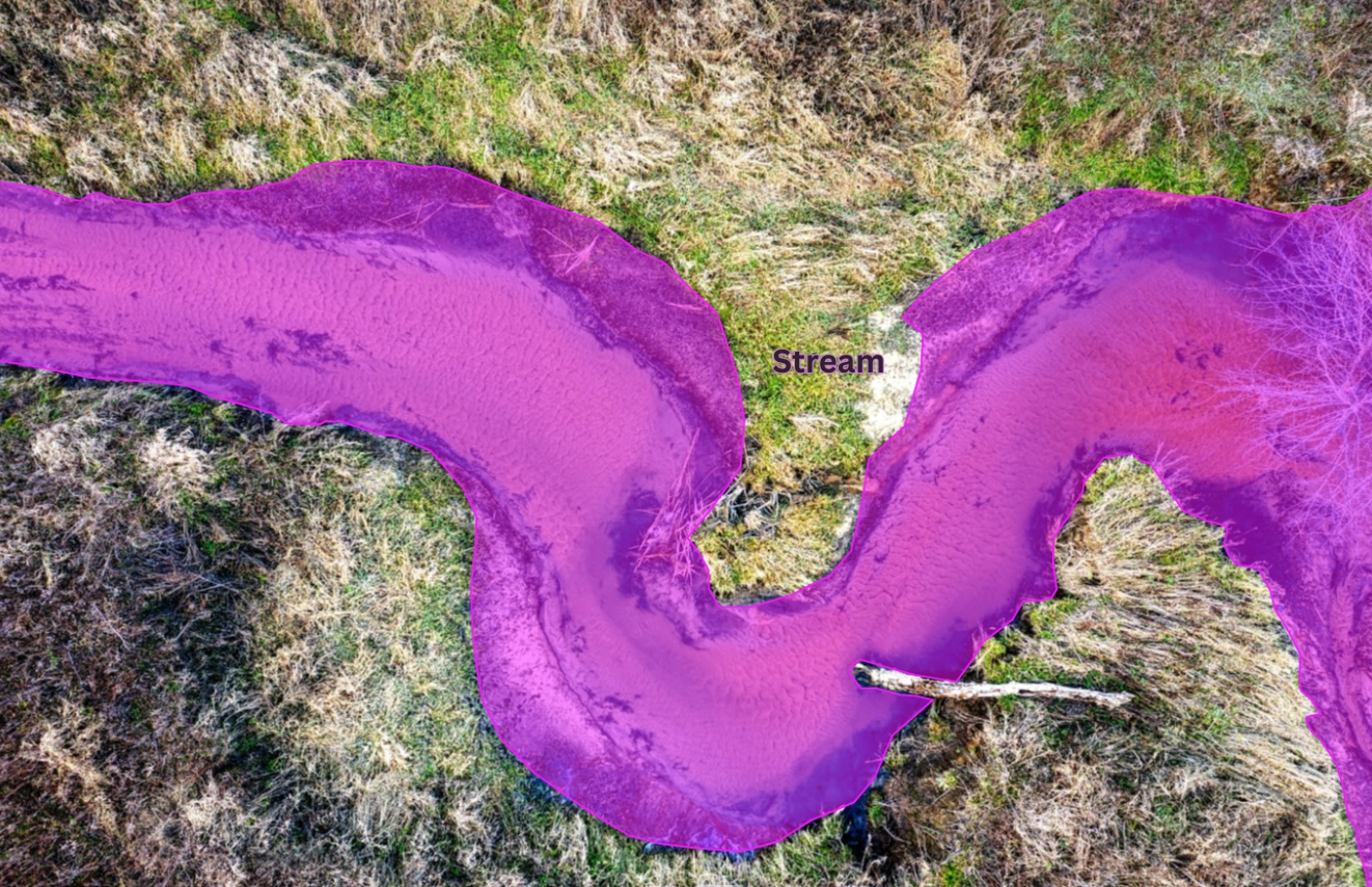
Environmental Disaster Detection & Precautionary Alerts for Coastal Areas
Our advanced environmental monitoring system is designed to protect coastal communities by detecting and forecasting natural disasters. Utilizing real-time data on factors such as water levels, seismic activity, and weather patterns, this system monitors critical environmental indicators to provide timely alerts for potential hazards like floods, tsunamis, and storms. Equipped with cutting-edge sensors and predictive analytics, it enables local authorities and residents to take precautionary actions, evacuate if necessary, and better prepare for natural disasters. Ideal for coastal regions, this solution minimizes risk and safeguards lives by offering early warnings and actionable insights for effective disaster management.
Mapping and Navigation
GIS technology is widely used for mapping and navigation in various industries, from personal navigation apps to logistics and fleet management. By integrating satellite data, GIS provides accurate, up-to-date maps with route information, real-time traffic data, and alternative routes. This capability is essential for applications like Google Maps, which help users navigate and explore new locations. For businesses, GIS-based navigation helps optimize delivery routes, reduce fuel consumption, and improve efficiency in supply chain operations.
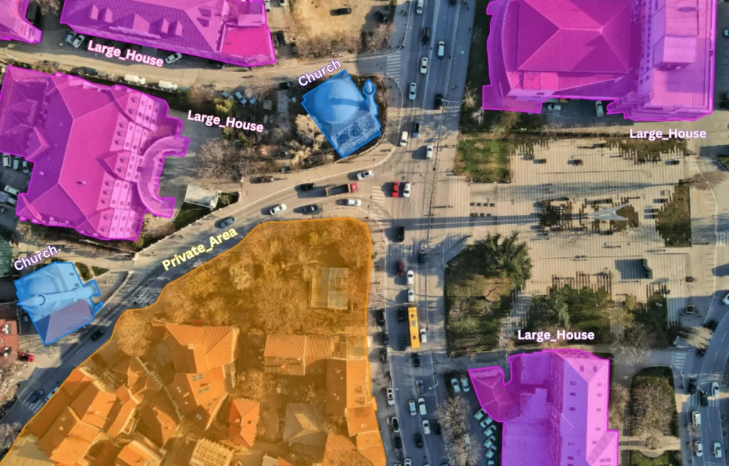
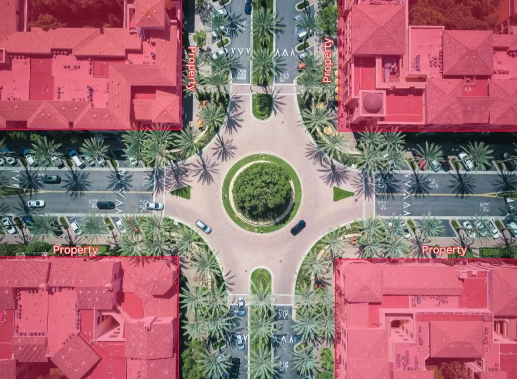
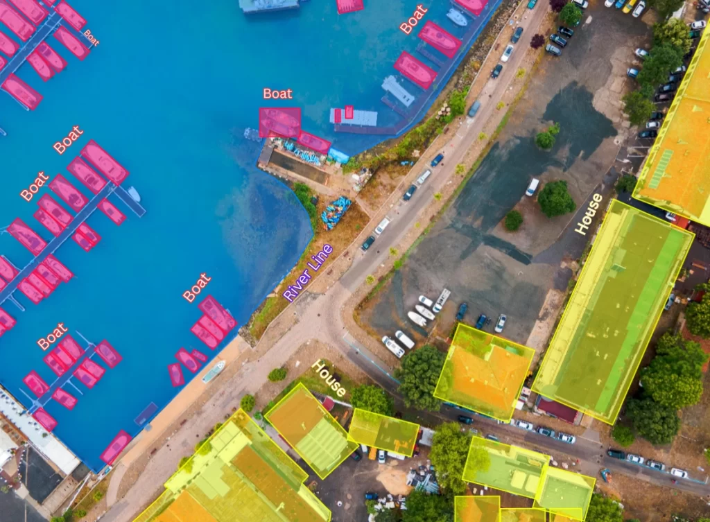
Urban Planning and Development
In urban planning, GIS supports the analysis and visualization of land use, population density, infrastructure, and green spaces. Planners use GIS to model potential developments, assess environmental impact, and make informed decisions about zoning, transportation, and public services. For example, GIS can help identify optimal locations for new parks, schools, or hospitals based on population needs. It also aids in disaster management by assessing flood zones and earthquake-prone areas, enabling cities to plan infrastructure more resiliently.